Summary
This website contains an interactive map exploring the possibility of integrating vertical gardens along the Egnatia Corridor of Thessaloniki, Greece. Above, the map contains many data layers collected from questionnaires as well as online sources. Below are a list of sites on the Egnatia Corridor where vertical garden implementation could take place. Spatial analysis and some structural considerations were taken into account for this demonstration, but there would need to be more considerations before actual construction.
Motivation
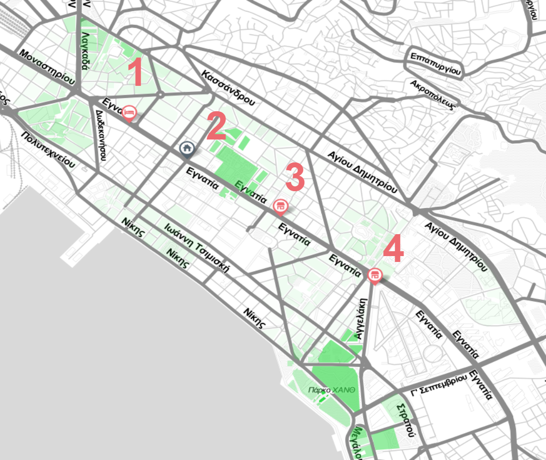
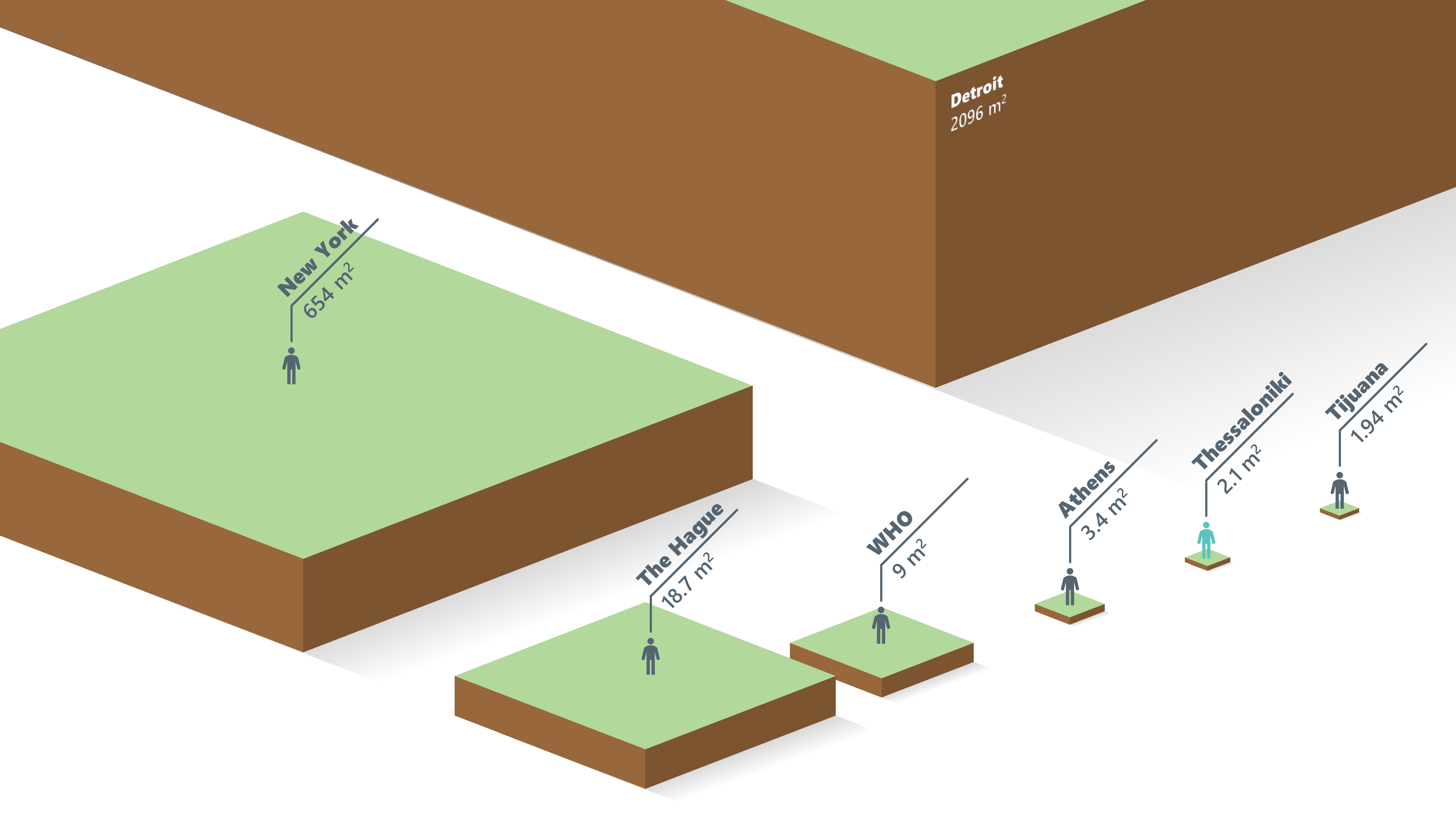
Thessaloniki has a shortage of traditional green spaces. Below, the city is compared to the World Health Organization (WHO) recommended minimum average green space per person along with other major cities. The lack of urban green spaces can be supplemented with vertical gardens in key areas. This website encapsulates research regarding a data driven approach to assessing the feasibility of vertical gardens in the area around Egnatia Street. Potential sites were also explored; each pin on the map represents a visited site. Click on a site pin for a picture of the location and a short description.
Data Layers
Relative Green Space: This layer started as a map of all building plots from The City of Thessaloniki. These plots were separated into two categories: green spaces and everything else. Every plot then had a set radius drawn around it. Every green space that had its center point in this circle had its area counted towards that plot's total. These totals were then turned into shades of green. White is the lowest concentration while bright green is the highest. This overlay shows the uneven and low concentration of green space around Egnatia Street.
AirBnB Heatmap: This is a heatmap of AirBnB price data in Thessaloniki scraped on the date 11/3/2019. Data was retrieved from Inside Airbnb. This is included to show the relative concentration of housing marketed visitors as well as suggest the property values in the city. White regions signify no data, while blue up to red regions signify increasing prices of Airbnb listings. Zooming in on the map allows one to see the individual placement of Airbnb listings.
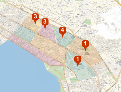
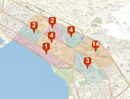
Liked and Disliked Regions Among other questions,
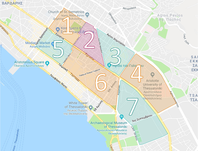 questionnaire respondents were asked to pick their favorite
and least favorite regions of Thessaloniki out of the seven
regions shown to the side. The brightest color on the overlay
corresponds to the most people selecting that region.
This data gives a general idea of which areas in the
city are most and least favored.
questionnaire respondents were asked to pick their favorite
and least favorite regions of Thessaloniki out of the seven
regions shown to the side. The brightest color on the overlay
corresponds to the most people selecting that region.
This data gives a general idea of which areas in the
city are most and least favored.
Pedestrian Data: This data layer includes pedestrian data along six major axes on the Egnatia Corridor. Pedestrian counts were collected by another research group in Thessaloniki. The project is credited to "Mapping the Complexity and Future Vision of the Egnatia Corridor" by Alexander Duffield, Marilyn Galdámez, Hector González and Christopher René. Relative pedestrian counts on these axes suggest areas that experience more or less pedestrian activity and can be used in conjunction with other datasets to suggest garden locations.
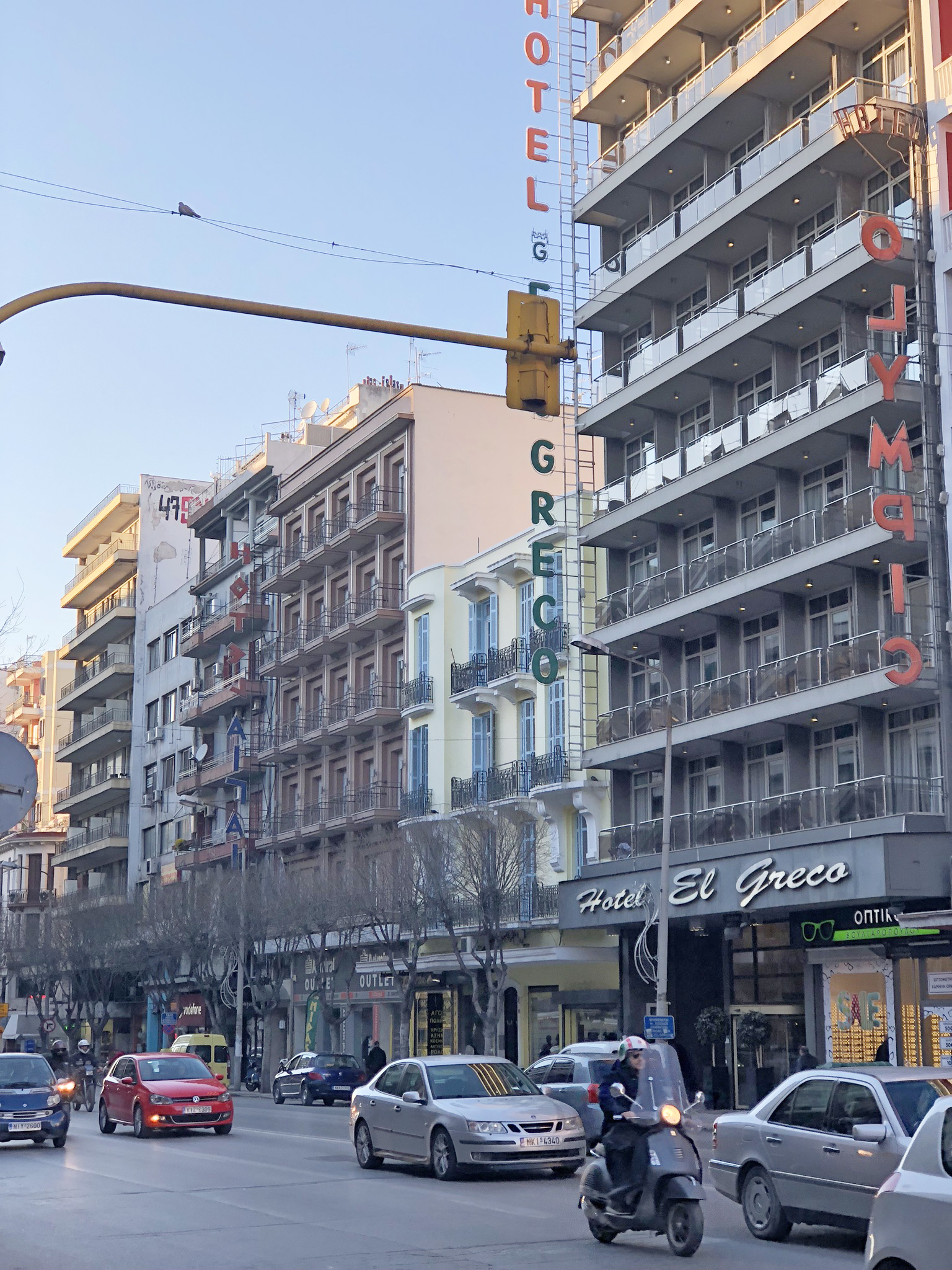
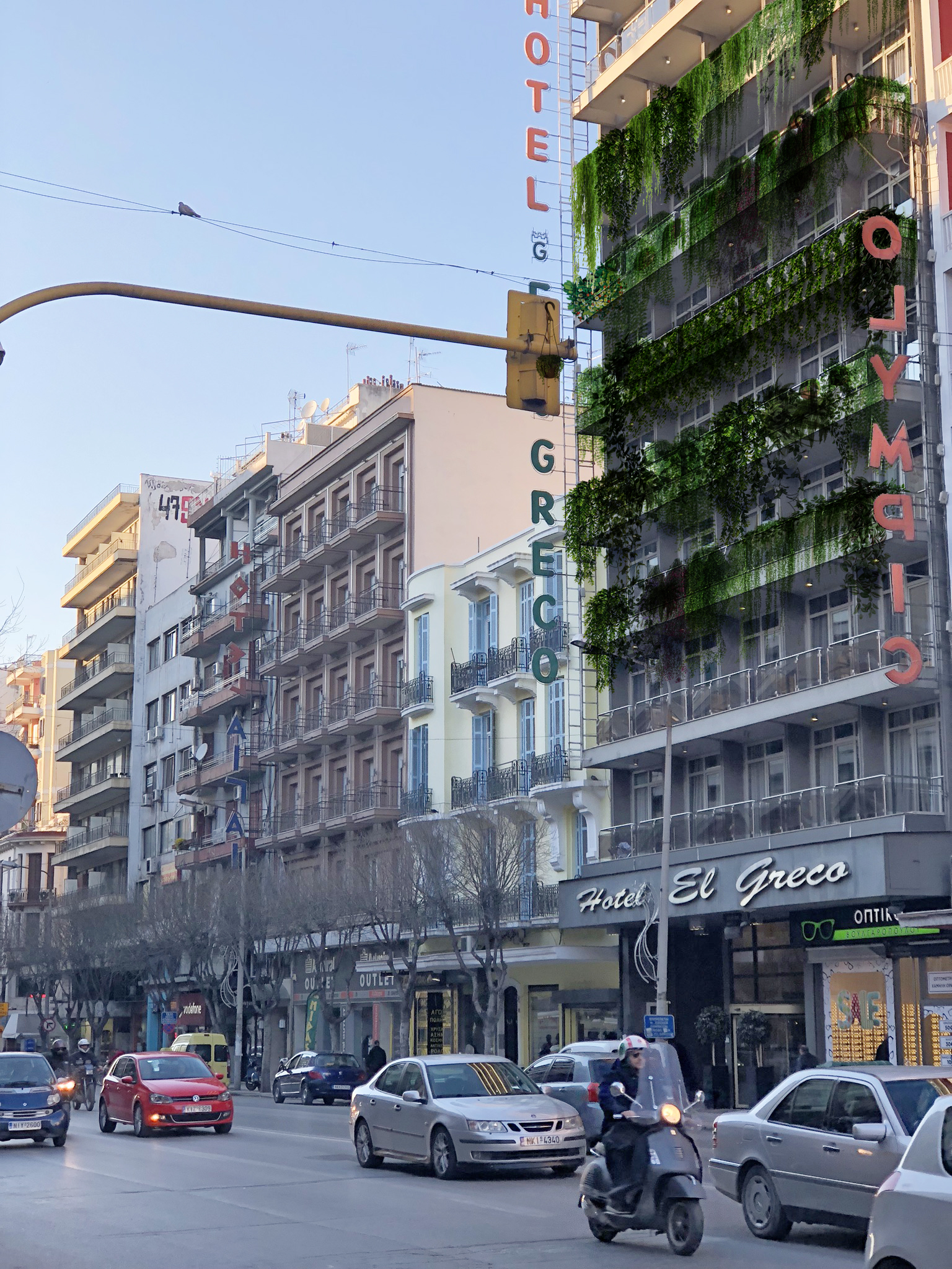
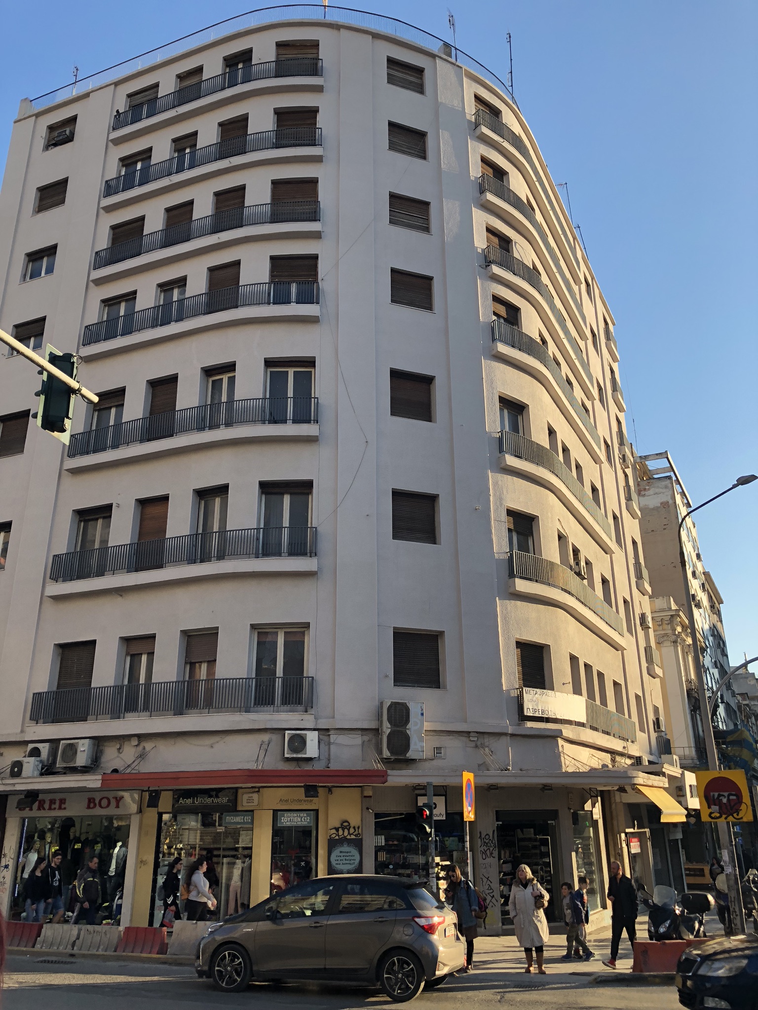
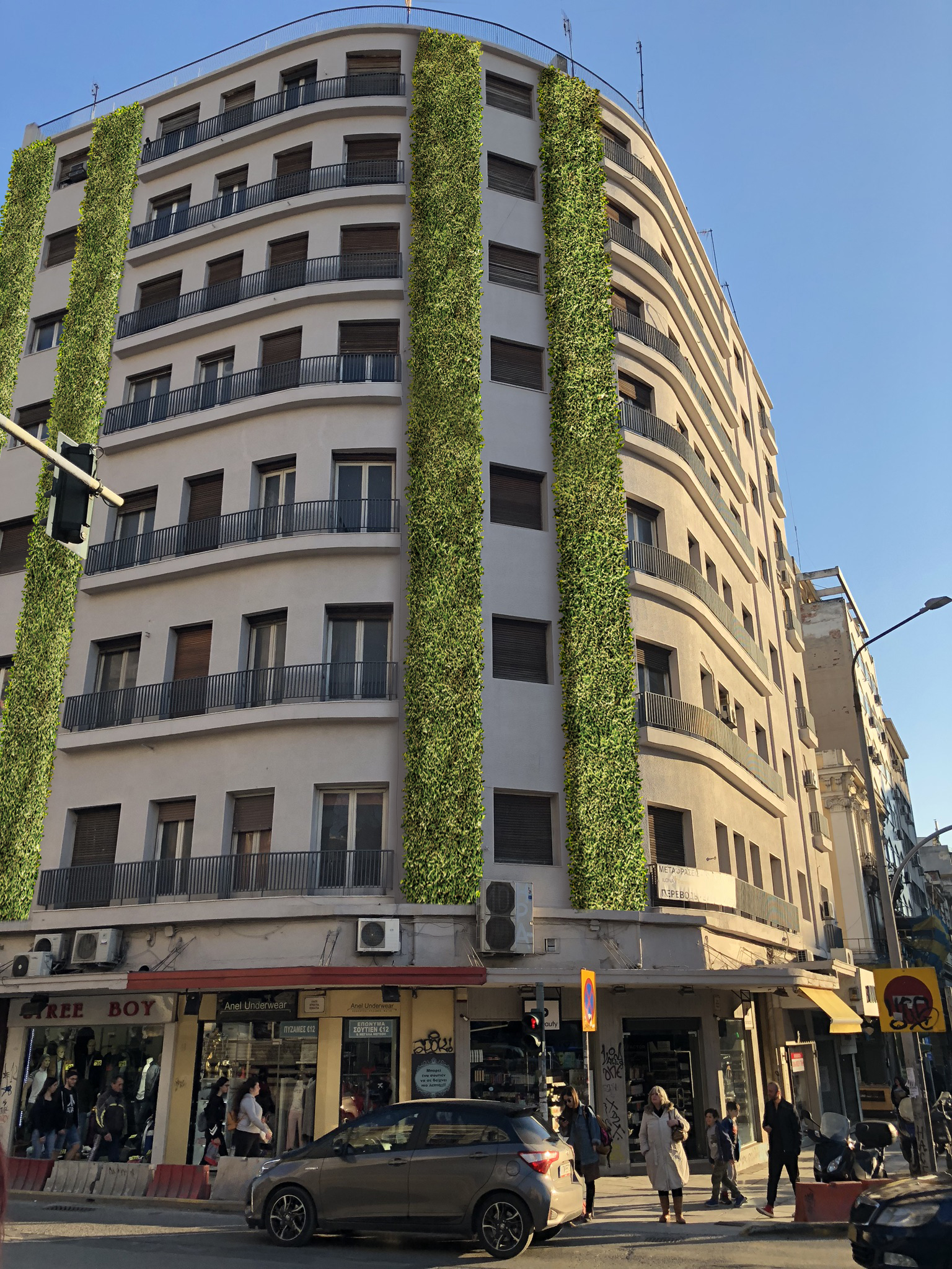
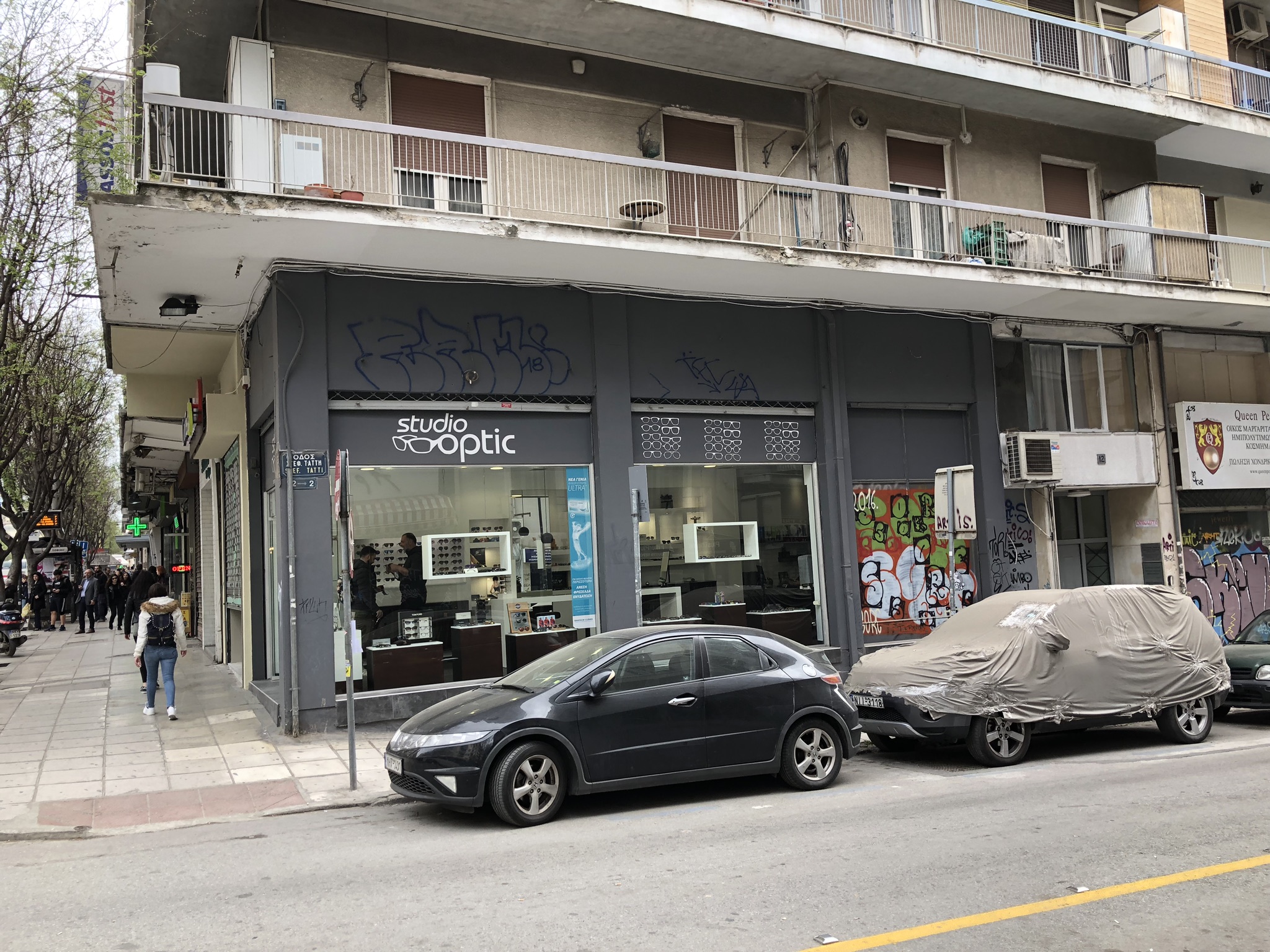
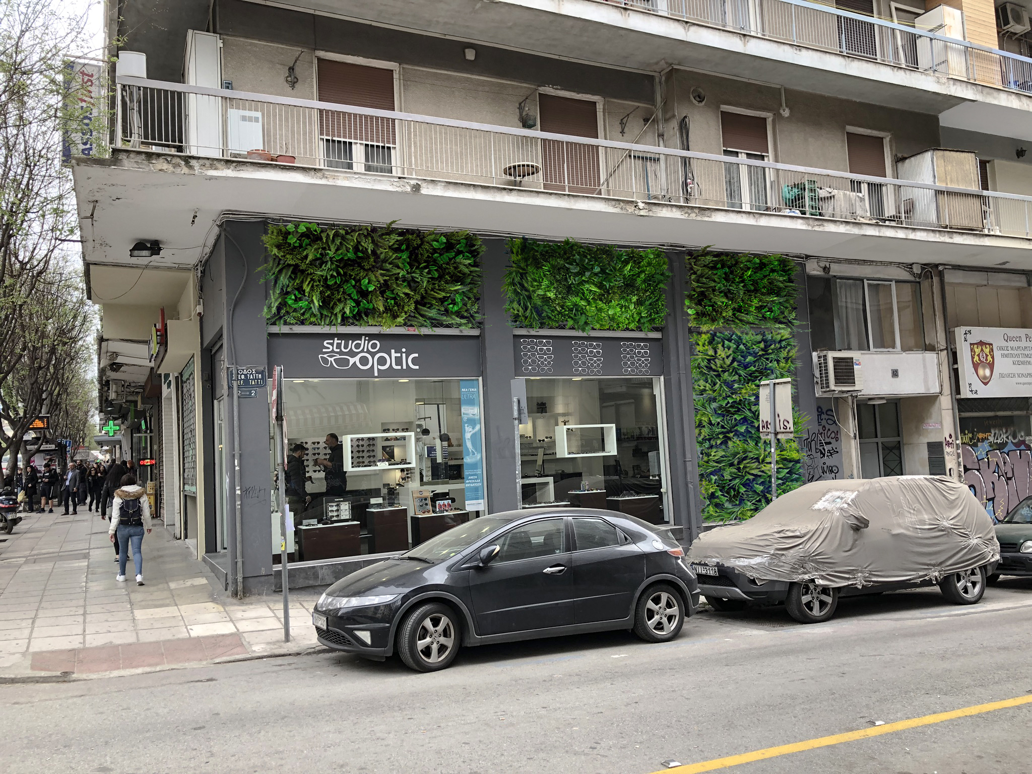
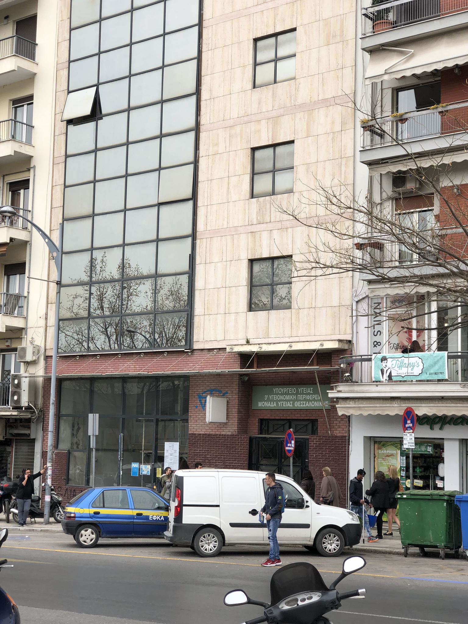
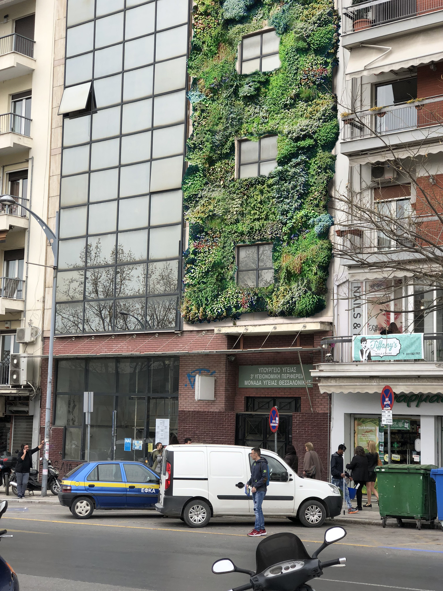
Prospective Sites: Sites are tagged with the following designations: mixed use, abandoned, hospital, hotel, school, and buisiness/government. All of these sites have short descriptors and categories with a picture. All of these sites have at least one area where a vertical garden could be implemented. Four of these sites have more detailed analysis below along with a rough Photoshop mock-up illustrating a conceptual design for a vertical garden at that site.